two-large-19th-century-u-s-coastal-surveys-of-the-lower-cape-fear-river
Lot 2166
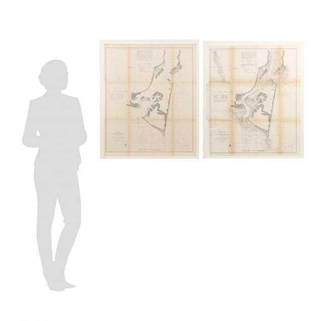
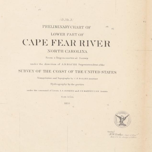
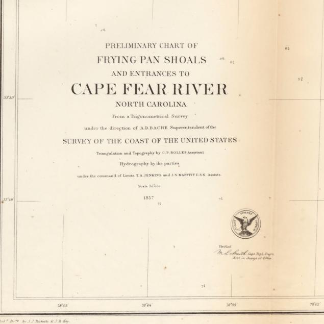
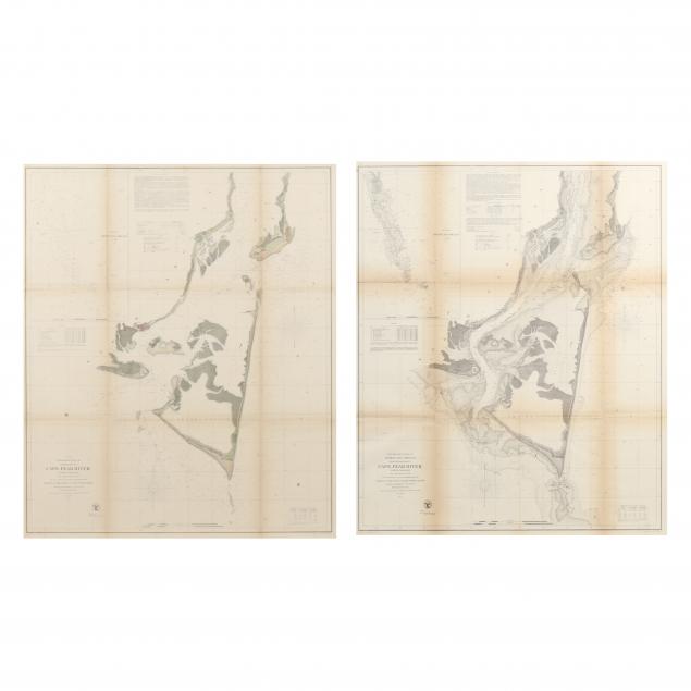
Two Large 19th Century U. S. Coastal Surveys of the Lower Cape Fear River
Lot Details & Additional Photographs
The first being Preliminary Chart of Lower Part of Cape Fear River North Carolina (1855), with an inset showing Frying Pan Shoals, the map with color, 27-1/4 x 33 in., some intentional paper loss to blank left margin; the second chart being Preliminary Chart of Frying Pan Shoals and Entrances to Cape Fear River North Carolina (1857), an updated version of the earlier map without color, 27-/34 x 32-1/2 in., also with intentional loss to the left margin.

Private North Carolina collection

U. S. Navy Lieutenant John Newland Maffitt is credited on these maps as being in charge of hydrography. Born at sea and growing up in North Carolina, he served in the Confederate Navy during the Civil War.

Browning along fold lines; overall creme age toning; good condition.