Lot 2169
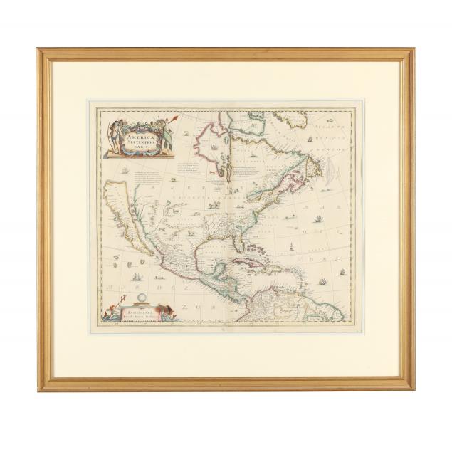
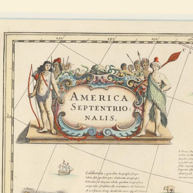
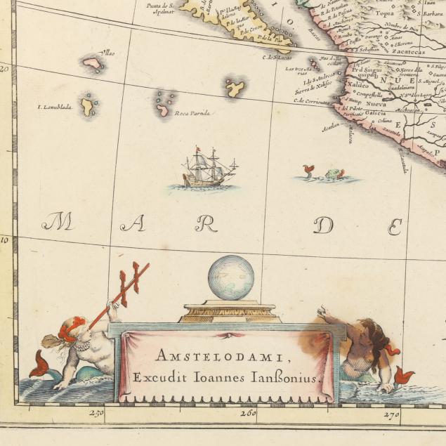
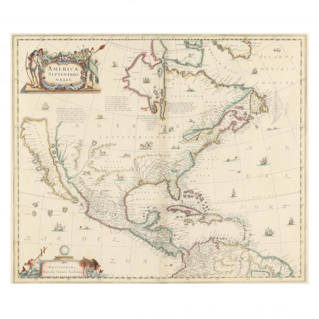
Hondius and Janssonius's Map of North America, with California as an Island
Explore more items like this one.
Visit our Historical Department Historical
Lot Details & Additional Photographs
Plate size 18 3/8 x 21 3/4 in.; frame dimensions 28 11/16 x 31 9/16 in.
Private North Carolina collection
An important map presenting the myth of California as an island, and with many key landmarks and settlements identified, such as Jamestown.
Good estate condition; with light toning, faint discoloration at center fold, a vertical crease, minimal foxing, minor grime, one dark stain on recto resulting from the "160" on verso, edge chipping and toning, and light mat burn; center fold reinforced on verso, not laid down, attached to mat at two small points at the top.