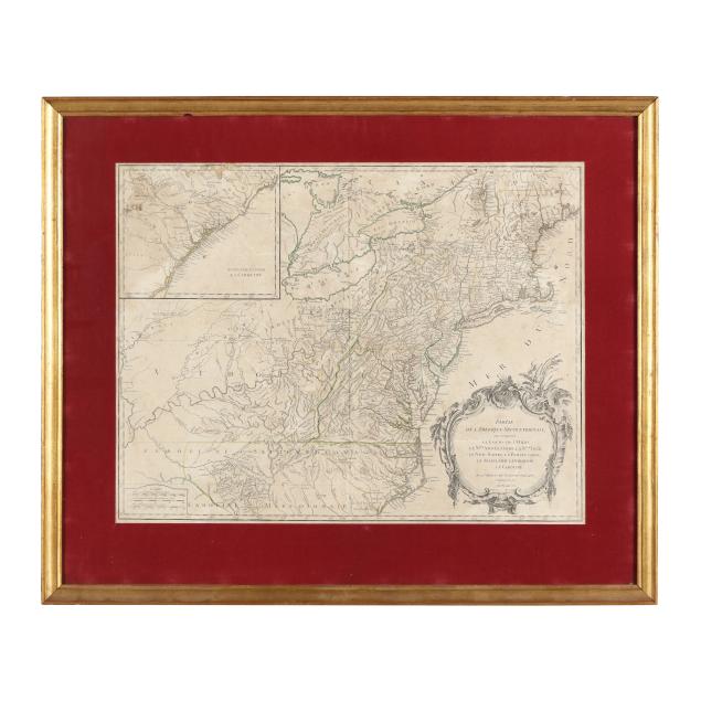
robert-de-vaugondy-s-18th-century-french-map-of-north-america-s-eastern-seaboard
Lot 1172
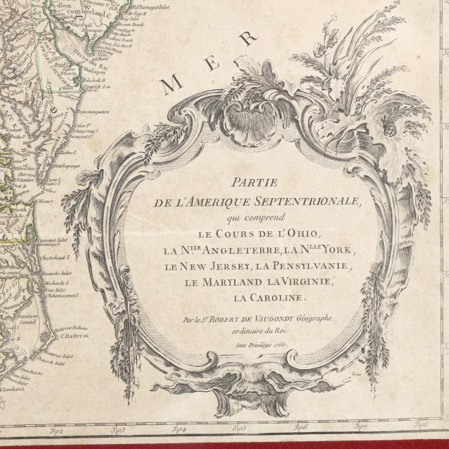
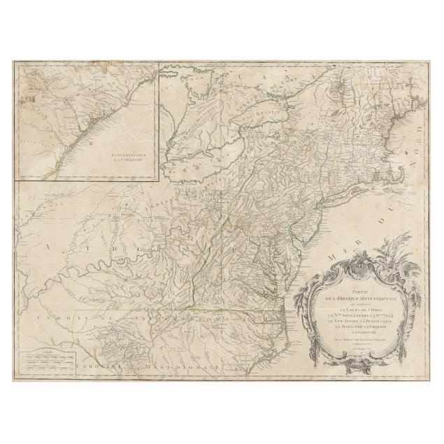
Robert de Vaugondy's 18th-Century French Map of North America's Eastern Seaboard
Lot Details & Additional Photographs
Robert de Vaugondy. PARTIE DE L'AMERIQUE SEPTENTRIONALE, QUI COMPREND LE COURS DE L'OHIO, LA N.LLE ANGLETERRE, LA NLLE YORK, LE NEW JERSEY, LA PENSYLVANIE, LE MARYLAND LA VIRGINIE, LA CAROLINE. [Paris], 1755. Engraving with some colored outlines. With supplemental inset showing the coast of Georgia and the Carolinas through Wilmington, and a large cartouche in the lower right corner presenting the title and date; presented behind a fabric mat and framed.

Image size 18 3/4 x 24 3/8 in.; DOA 26 7/8 x 32 1/2 in.

From the Collection of the late Michael Joyce and Archie Carter III, Greensboro, North Carolina
Proceeds to Benefit Greensboro Urban Ministry

Areas of loss, wear, and creasing along the upper edge; central fold; overall age toning and foxing with areas of spotting; light wear/chipping to frame with small loss at top; not examined out of frame.